
Qinghai Province
Discover the evolution of this region through history.
 Évariste Huc
 China, an introduction
 Hebei
 Inner Mongolia
 Ningxia
 Gansu
 Qinghai
 Tibet
 Buddhism
 Behind the scenes
 The Quest for the Celestial Dragon
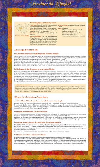
Thematic canvas
From the exhibition panel
The text below is excerpted from the thematic canvas shown alongside it.
160 years of change to the present day — In the 20th century, China redraws the boundaries of Qinghai province.
During the 1950s, the Chinese redefined Tibet's borders and expanded the neighboring Chinese provinces. Qinghai province joined the People's Republic of China, absorbing the Amdo region (a former Tibetan territory). It includes the vast expanse of Lake Qinghai ("Blue Sea," in Chinese), formerly called Lake Koko Nor, and a large part of the Tibetan plateau bounded to the south by the Tanggula mountain range.
Qinghai, from nomadism to settlement: while nomads still roam the high Tibetan plateaus, the shores of Lake Qinghai are mostly home to semi-nomadic or settled Tibetan and Mongol communities who continue to raise sheep and yaks. New Chinese trading towns are also developing along the lakeshore, meeting points for the various ethnic groups who come to sell their local produce.
"Heading southwest, one meets the Mongols of Koko Nor, or Blue Lake. The Mongols of Koko Nor occupy only the surroundings of the lake that gave them their name. Further still, at the very heart of Tibet, one encounters other Mongol tribes."
— Évariste Huc — Recollections of a Journey through Tartary and Tibet
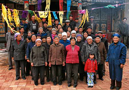
Villagers gathered for a religious event at a Buddhist temple, Xining valley
Every village has its modest shrine, the lhakhang, "house of god." Buddhism is estimated to have 150 million followers in China.
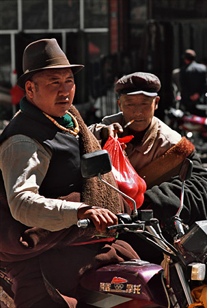
Mongol nomad in the village of Ganca, on the northern shore of Lake Qinghai
The Mongols of Koko Nor occupy only the surroundings of the lake that gave them their name; other Mongol tribes are found deep within Tibet itself.
"Heading southwest, one meets the Mongols of Koko Nor, or Blue Lake. The Mongols of Koko Nor occupy only the surroundings of the lake that gave them their name."
— Évariste Huc — Recollections of a Journey through Tartary and Tibet
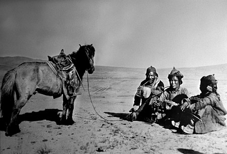
Photograph from the early 20th century (Paris Foreign Missions)
Bandits sometimes made off with the herds of Tibetan caravans that came to sell furs, butter and wild tea at Tang-keou-eul.
"The next day, the town of Tang-keou-eul was the scene of a dreadful disorder. Bandits had appeared nearby, and had made off with two thousand oxen belonging to the Houng-mao-eul, or Long-Haired Ones."
— Évariste Huc — Recollections of a Journey through Tartary and Tibet
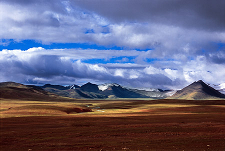
Glaciers of the Tanggula range, above 5,200 m
This mountain range traces the border between Qinghai province and the Tibet Autonomous Region. Legend says even eagles cannot cross it.
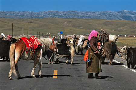
Caravan of Tibetan nomads on the road to Lake Qinghai, near the village of Hemahe
The old virtual borders of the Mongol banners disappeared by the late 19th century, replaced by fences that today's nomads now skirt along modern roads.
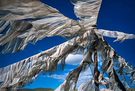
Prayer masts (targo) on the Tibetan plateau, at 4,600 m
The targo is a mast hung with prayer flags. The wind is believed to carry off, far and wide, the blessings of the sacred texts printed on them.
And 33 more photographs with captioned panels…